

Mount St. Helens erupted 43 years ago Thursday: Here's how it unfolded

Mount St. Helens erupted 43 years ago
It was 43 years ago on May 18, that Mount St. Helens exploded to life, erupting in violent fashion, spewing towering clouds carrying 520 million tons of ash that choked the skies with grit and darkness and claiming the lives of 57 people in what remains the largest volcanic eruption in American history.
MOUNT ST. HELENS, Wash. - It was 43 years ago on May 18, that Mount St. Helens exploded to life, erupting in violent fashion, spewing towering clouds carrying 520 million tons of ash that choked the skies with grit and darkness and claiming the lives of 57 people in what remains the largest volcanic eruption in American history.
While the most devastating acts occurred on that fateful day, scientists began getting an inkling something was up a little more than two months before the eruption.
For this year's anniversary, the U.S. Geological Survey poured back over its historical records leading up to the eruption, providing day-by-day updates on social media mimicking what happened 43 years ago each day before the mountain blew.
8 weeks before Mount St. Helens Eruption: March 20-23, 1980
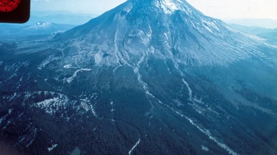
Mount St. Helens had slept peacefully for 123 years while nestled in its spot in southwestern Washington along the Cascade Mountains; a tall, majestic snow-capped mountain that dotted the horizon in between sisters Mount Rainier, which sits closer to the Seattle area, and Mount Hood near Portland.
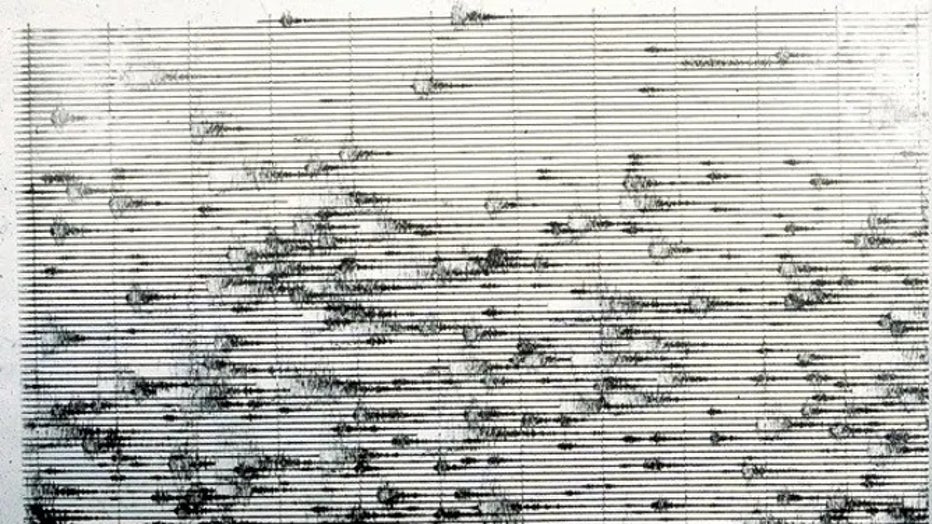
The mountain only had 44 documented earthquakes between 1975 and early 1980. However, on the afternoon of March 20, 1980, the ground began to shake. Seismologists measured a 4.2 magnitude quake at a shallow depth.
Over the next three days, seismologists would measure dozens of quakes a day.
Seismic activity roars to life along Mt. St. Helens between March 20-23, about 8 weeks before Mt. St. Helens would erupt.
Seismologists raced to the mountain to install more seismometers around the volcano as another 4.2 quake rattled the mountain on March 22 and another greater than 4.0 struck on March 23. Scientists determined the quakes were not "typical" quakes with aftershocks, but many individual quakes, indicating a potential precursor to volcanic activity.
Frustration soon surfaced when seismologists returned to the mountain only to find their new portable seismic recorders are not working correctly due to bad batteries.
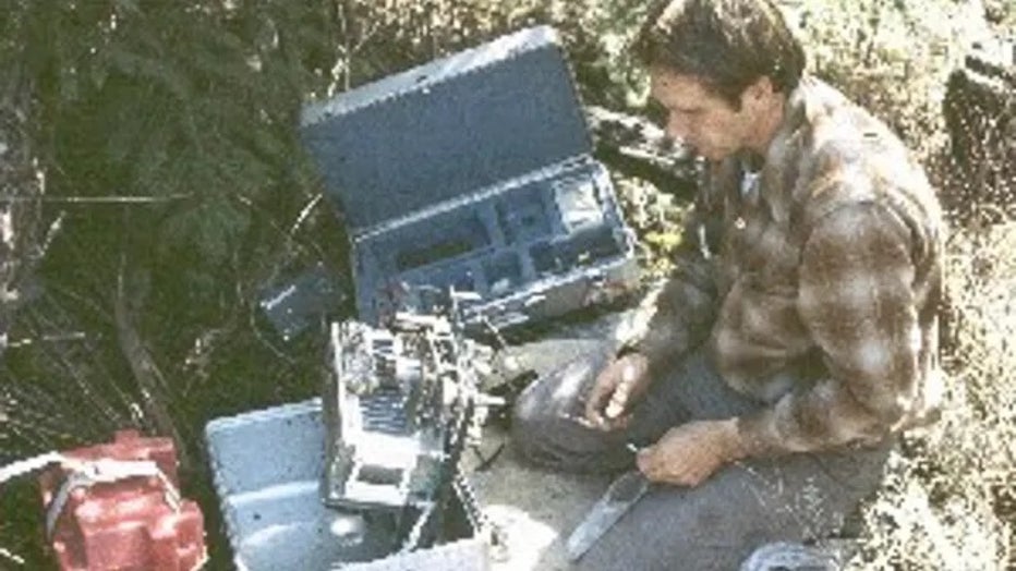
Seismologists visit the portable seismic data recorders deployed Mar 21, 1980 and are frustrated to find the stations not functioning properly due to bad batteries. (USGS)
March 24-31, 1980: 'Bedlam' begins
On March 24, 1980, the USGS's David Johnston visited the Pacific Northwest Seismology Network's lab at the University of Washington in Seattle and finds "bedlam" as the quake count neared 500 per day while the mountain trembled every few minutes.
The quakes triggered avalanches on the snow-capped summits but otherwise were not causing any damage yet.
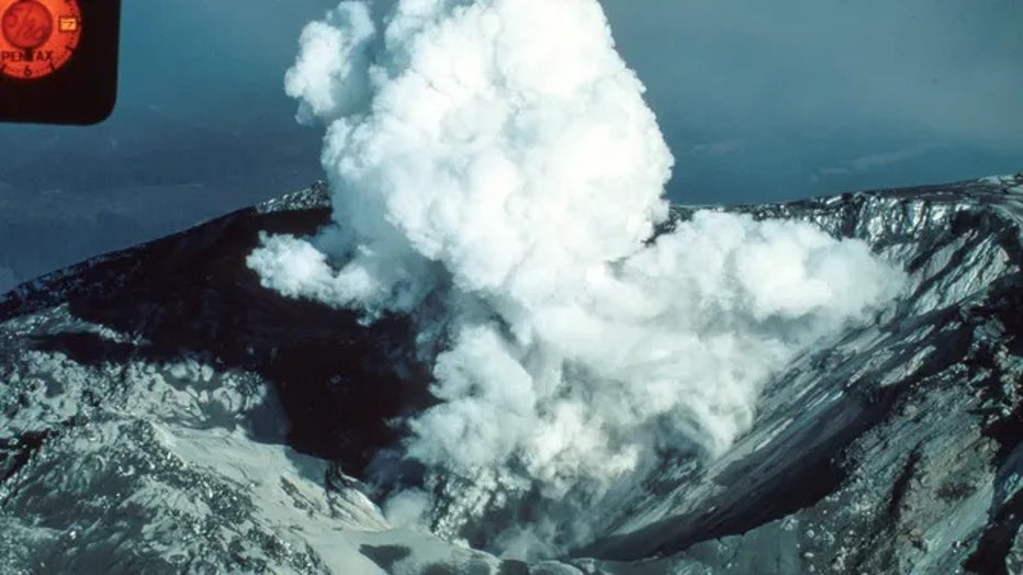
The first visible signs of a possible eruption came on March 27, when the first steam and ash explosion opened up a crater 200-250 feet wide and 80-100 feet deep, according to the USGS, That prompted evacuations within a 15-mile radius of the volcano and roadblocks to keep out the curious.
Mar 28, 1980: Ash bursts from the summit of Mt. St. Helens and rises 2 miles.
A dozen more bursts of ash continued into the 28th, each lasting minutes to hours.
"It's like standing next to a dynamite keg with the fuse lit - only we don't know how long that fuse is," Johnston said at the time.
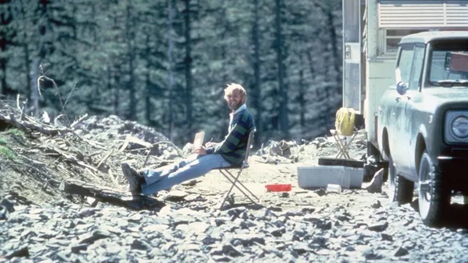
Mar 30, 1980: The USGS pitches an army tent in the snow above Maratta Creek and call it the Coldwater observation post.
More steam and ash explosions continued into the 31st – one bringing ash to the town of Kelso about 35 miles away.
Still, the largest problem that day was keeping gawkers at a safe distance. The National Guard came in to help enforce roadblocks.
April 1-7, 1980: The mystery deepens
Larger quakes and more vigorous explosions marked the start of April, indicating an increased possibility of an eruption. However, USGS scientists at the time suggested it was more likely a series of small eruptions would occur instead of one large cataclysmic event.
Apr 2, 1980: Larger earthquakes, harmonic tremor, more vigorous explosions indicate an increased possibility of an eruption.
The weather cleared enough again April 3, 1980, for scientists to fly over the summit and get a peek at the bulging mountain. Explosions sent plumes upward almost hourly, and winds carried ash east about 50 miles to the town of Glenwood.
Steam vents from Mt. St. Helens on April 4, 1980.
Snow storms returned to the mountain on April 5, but scientists were still putting in 14-hour days to collect ash, measure gasses and install new equipment.
Weather turns cold, snowy. Field teams put in 14+-hr work days to collect ash, track surface changes, measure gases, keep stations running, install new equipment.
April 8-13: The waiting game ensues
By April 8, 1980, volcanologists noted what may be a "new reality" of a relatively stable pattern where melting snow ran into the crater and was blasted into steam by the bubbling hot volcanic cauldron.
The mountain occasionally belched some ash – on the 9th, the ash carried into the Puget Sound region, meaning just about every corner of Washington received ash at some point.
The rest of the week, the mountain settled into "ho-hum" steam and ash explosions. Attention waned and the media moved on to more pressing stories. With the constant monitoring also a constant drain on the USGS budget, some staff members returned to their regular jobs.

Harry Truman, owner of the Spirit Lake Lodge and long-time resident of the Mount St. Helens vicinity, refuses to evacuate his home near the dormant volcano. | Location: Near Mount St. Helens, Washington, USA. (Getty Images)
The 11th provided a fateful encounter as scientists went to check on local mountain resident Harry Truman who lived at a lodge along the mountain's Sprit Lake for 54 years. He swore that despite the danger, he would not leave. Truman did not live to see his 55th year at the lake, becoming one of the 57 people who perished in the eruption.
April 14-22: The media pokes the bear
April 14, 1980, marked nearly a month since the volcano had sprung to life, but a local newspaper chided Mount St. Helens for putting on a "half-hearted" show. Four days later, another paper panned the mountain for its "listless performance." One local TV station was brazen enough to send their helicopter to the summit to get footage of it.
"The area is closed, but it's hard to enforce," the USGS wrote.
The volcano occasionally sent out steam plumes, and seismic activity remained "moderate."
April 23-28: New worries emerge
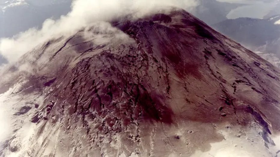
As the weather cleared once again, scientists sent choppers to get fresh aerial photography of the summit. A bulge was found on the north side that had moved some 300 feet up and out from where it was the previous year.
WATCH A VOLCANO MAKE ITS OWN WEATHER
Meanwhile, the quake count for the entire reawakening had reached 1,500.
A sensor placed at Goat Rocks about midway up the mountain's slope was found to have moved 3 yards to the north.
April 29-May 3: Getting ready in case the mountain blows
Concerns rose that there would be a massive avalanche on the bulging northern flank of the mountain, which would dump debris into Spirit Lake and instantly flood the North Fork of the Toutle River.
Toutle Lake School, some 26 miles downstream, started conducting volcano drills and practiced loading 511 students and 85 staff members onto school buses to head to higher ground.
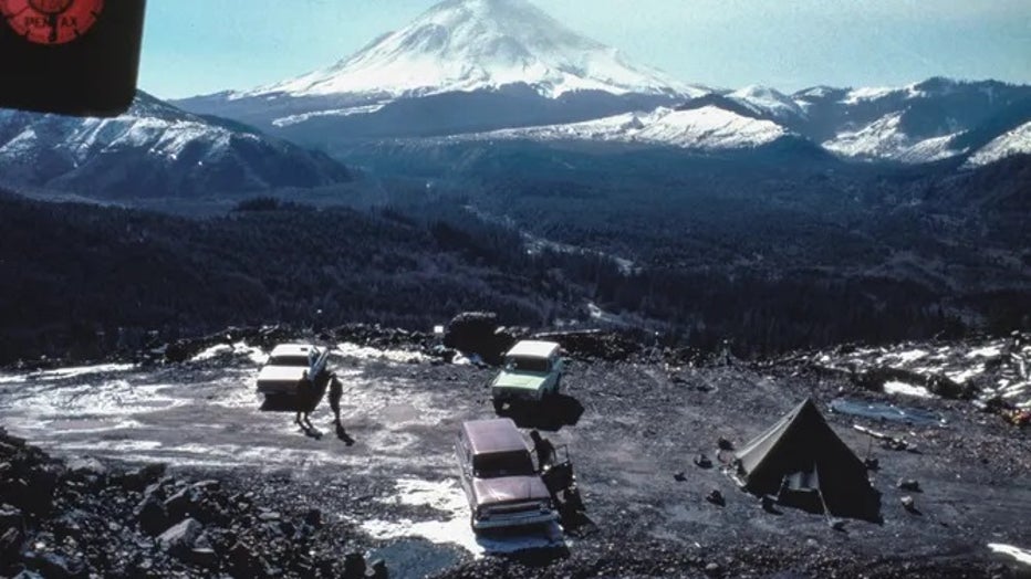
Meanwhile, officials installed new gates to lock down access to the northern side of the mountain as scientists established a new monitoring site closer to the volcano, just 5.5 miles from the summit. The "Coldwater II" site was staffed 24/7 to enable constant monitoring.
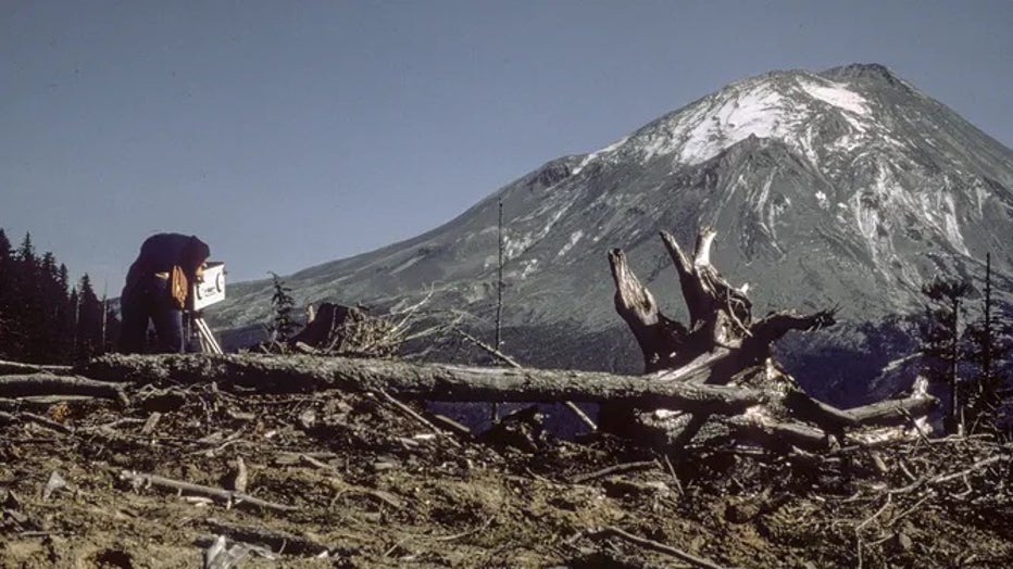
A new observation post is established closer to the volcano, on a ridgetop 5.5 mi from the north flank. Coldwater II is equipped with cameras, monitoring equipment and radios. A travel trailer is home to USGS staff at the site 24/7.
May 3-6: St. Helens becomes ‘misshaphen, ash-tarnished rebel’
Other than measurements that the bulge near Goat Rocks was moving about 4-5 feet a day, the USGS said the volcano hadn't done anything to convince a non-scientist that a hazard existed. If not for news media reports highlighting how much the bulge was moving, the growing clamor to ease restrictions in the area would've grown louder.
May 5, 1980 Scientists state bulging north flank results from magmatic intrusion into volcano during late March.
"Local residents growing weary of life near an active volcano," the USGS said. "Like saint-turned-sinner, the mountain has gone from a calm, dependable friend that radiated beauty, to a misshapen, ash-tarnished rebel. Nobody knows what to expect next."
May 7-11: Mount St. Helens reawakens
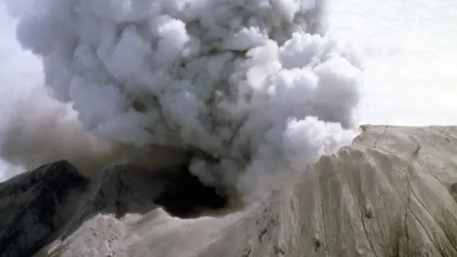
The volcano's two-week break came to an end as bursts of steam and ash reached 13,000 feet on May 7, 1980, while the bulge continued to move and quakes shook.
The volcano resumes phreatic activity after a two-week lull, sending bursts of steam and ash as high as 13,000 ft.
As the bulge continued to grow and move, scientists believed it was only a matter of time before the bugle failed and a massive mudslide ensued.
Meanwhile, officials kept pleading with Harry Truman to leave his Spirit Lake-front cabin.
May 12-17: The precursors to disaster
On May 12, 1980, a strong 5.0 quake shook loose an 800-foot-wide avalanche of ice and rock on the north side while ominously, the crater's high point stood 500 feet taller than it was two months earlier.
In the days after, the mountain goes quiet again. In a twist, scientists were baffled when a meeting with officials where it was assumed they would discuss expanding restricted areas instead turns into talks of which areas could reopen for Memorial Day weekend.
Mt. St. Helens gives off steam on May 13, 1980.
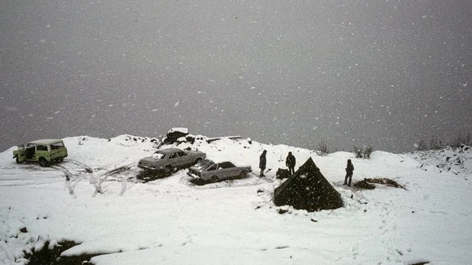
Cabin owners inside the restricted "red zone", who had been clamoring for access while threatened with $500 fines and 6 months in jail if they enter the restricted area, were finally granted access to visit their cabin on May 17. Cabin owners signed waivers and headed to their homes to pack up items before leaving by the end of the day.
USGS's David Johnston was the lone team member to stay at the Coldwater II monitoring site on the night of the 17th.
David Johnston at Coldwater II, 1900 hours, May 17, 1980. Dave did not survive the next day's eruption. Coldwater II would eventually be re-named "Johnston Ridge" in honor of Dave.
May 18: A quiet early morning then ‘Vancouver! Vancouver! This is it!’
A 7 a.m. check on the mountain from Johnston found nothing unusual. The 7:30 a.m. morning meeting was also mundane.
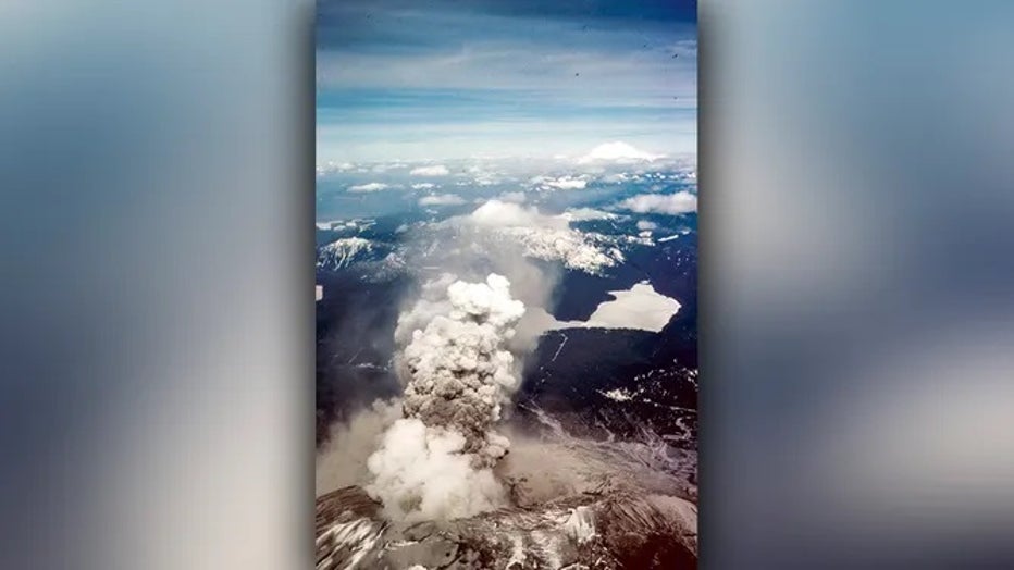
Then at 8:32 a.m.: "Vancouver! Vancouver! This is it!" radioed Johnston from the lookout point as the mountain violently erupted. Vancouver didn't hear the warning, but the message was heard and recorded by a ham radio operator.
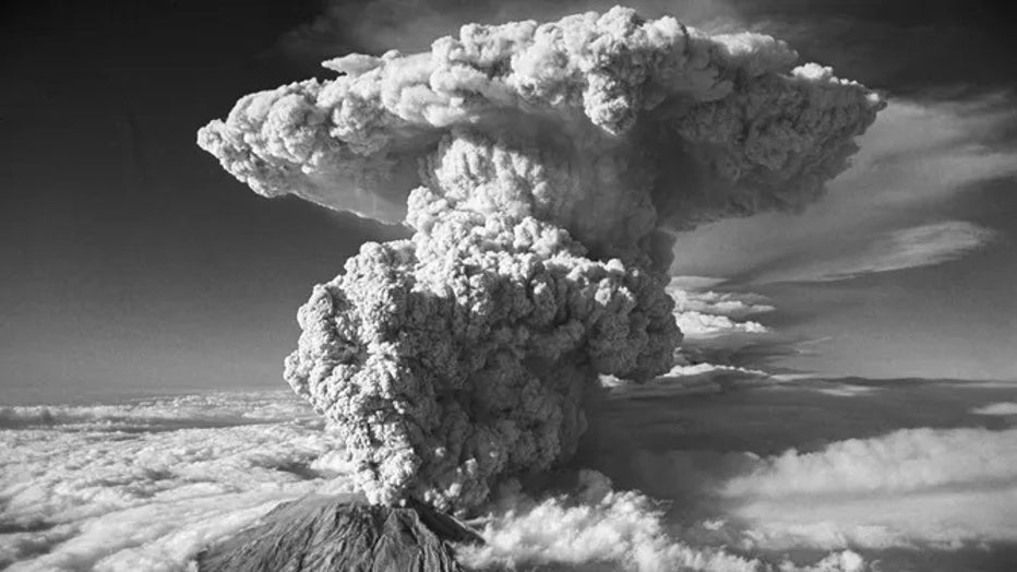
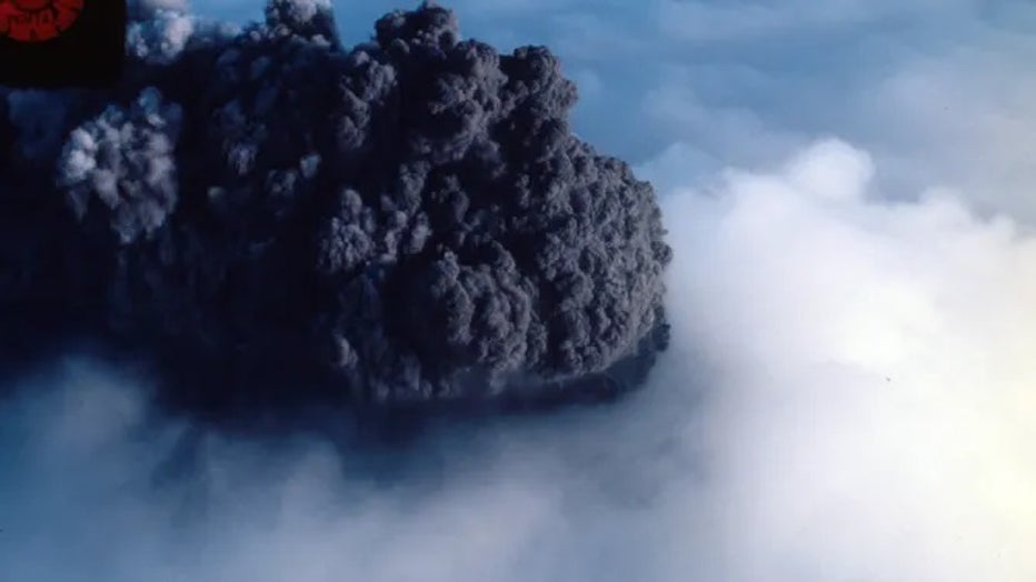
(Original Caption) 7/23/1980-Spirit Lake, WA- Looking more like a smoke cloud from an A-bomb blast than steam and ash from a volcano eruption, Mt. St. Helens sent this plume of steam and ash some 60,000 feet in the air, as the volcano awoke from a si (Getty Images)
A mad scramble ensued. Campers by the Green River reported hearing distant sounds, then blasted by winds as the skies turned pitch black and the ground vibrated. Trees blew over as mud and ice rained down. It was a cold blast at first, but soon everything began to burn and warm ash started to fall. The campers scramblee to walk out.
Geologists from Spokane were on a helicopter ride near the crater moments before the blast and witnessed a mile-long fissure in the volcano as the eruption started. The pilot dove from the skies and managed to safely fly back to Portland.
Broadcasters scrambled to find out what was happening and get on the air. Loggers in the area heard screams about a volcano as trees jiggled and fell as they were knocked down by the wind. Massive mudflows from instantly-melted snow raced down mountains and flooded the nearby terrain under feet of water and mud, wiping out roads and bridges along the way. Day turned to night in communities in Eastern Washington as upper-level winds spread thick clouds of ash across the skies.
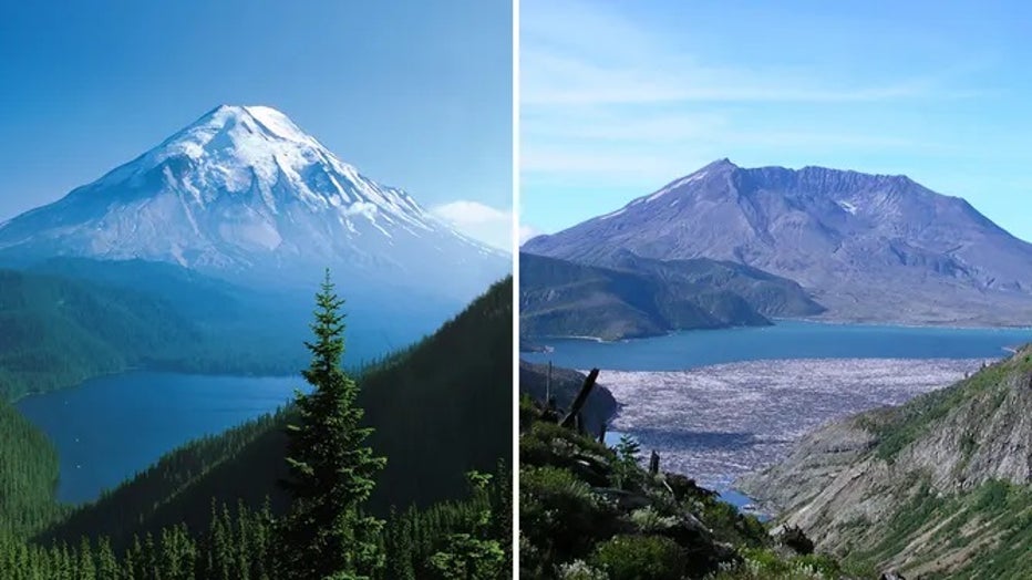
A before and after look at Mt. St. Helens.
In the aftermath, the USGS sadly learned that Johnston did not survive the eruption, becoming one of the 57 people killed that day. An aerial tour of the devastation confirmed the Coldwater II lookout was destroyed. Johnston's legacy lives on both at the USGS and at the volcano.
The Coldwater II site was renamed the Johnston Ridge Observatory in his honor.
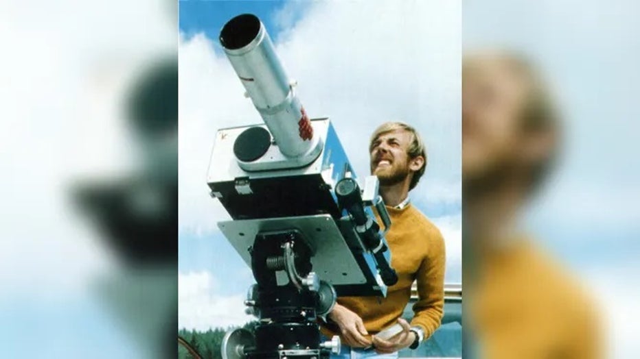
David Johnston
As mentioned earlier, Spirit Lake Lodge resident Harry Truman also lost his life when the mountain erupted.
So much more happened on that fateful day. The USGS is running a timed Twitter thread all day Thursday with minute-by-minute accounts of what happened on May 18, 1980, and beyond.